VIENNA -- It took just 90 days for a team at Salisbury University
to solve part of a centuries old historical mystery -- locating sites
visited by Capt. John Smith during his exploration of the Nanticoke
River in 1608.
Now researchers have pinpointed three areas along the western
shore of the river where Smith came face to face with American
Indians. It has long been speculated that one site in particular is
now the township of Vienna.
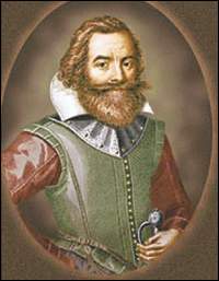
Michael Scott, associate professor in the department of geography
and geosciences at Salisbury University, is excited about the mixing
of 400-year-old cartography with today's digital technology to prove
with almost "75 percent certainty" that Capt. John Smith paid a call
to this riverside community.
"The John Smith Project"
The Vienna town council paid SU $2,000 for the soon-to-be-released
report, dubbed "The John Smith Project," to determine if Smith came
ashore here. To do that, Scott and his team relied on Smith's own
map.
"We have provided maps for the comprehensive (economic) plan of
Vienna a couple of years ago and they were familiar with our work. We
are an Eastern Shore Regional Geographic Information Systems
cooperative to help towns and counties with a variety of projects,"
Scott said.
"In discussing economic development strategies for Vienna, Mayor
Russ Brinsfield said he wanted to increase traffic downtown and
establish an interpretive center along the Nanticoke River to look at
the natural and historic aspects of the river and town. He wanted us
to scientifically look at the John Smith map printed in 1612 about
his voyage up the river in 1608 and see if we could overlay it over
today's maps and see if he did, in fact, stop at what is now Vienna,"
said Scott.
The Smith map, having been drawn almost 400 years ago, lacks
longitude and latitude references, so Smith's notation of his stops
along the river are approximate, but not precise.
The 1608 explorers are thought to have sailed the Nanticoke aboard
a shallop, a 30-foot-long boat that held a 12-man crew. The open
vessel relied on sails, but was outfitted with oars for rowing.
On his three- or four-day exploration of the river, Smith noted 10
sites he visited, three past Vienna, toward Blades. On the western
side of the Nanticoke, his first stop was at the Indian village of
Nause (long believed to have been Green's Island near Elliott's
Island). Scott's work tentatively confirms the site was near
Elliott's Island.
Truth to the legend
For Elliott's Island history buff and author Ann Foley, that's
good news. "This bears out the accuracy of local legend that says
Smith stopped at Green's Island. Years ago, a plaque was placed there
by several Dorchester County men noting his visit, a spot they
located long before the technology that's now available to
researchers," Foley said.
Smith's second stop was at Nantaquak village (thought to be in the
Lewis' Wharf vicinity) and then to Kuskarawaok. As Scott sees it, it
was at Kuskarawaok that the crew encountered American Indians ("four
came to us in their canoe") and invited them to their village, as
detailed in Smith's account.
"What we found, was that one of the primary Indian villages,
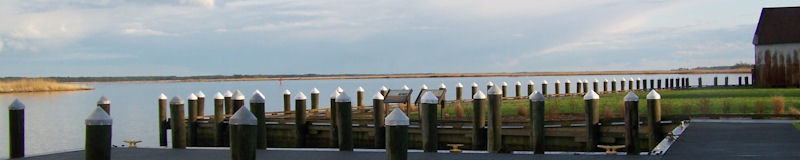
called Kuskarawaok (and later an Indian reservation), is near what is
now Emperor's Landing, the site of Vienna. Smith's map shows a lodge
at Kuskarawaok, and this indicates the 'king's home,' " as Smith
perceived it, said Scott.
"Indeed John Smith stopped at (what is now identified as)
Emperor's Landing and met 200 (or 2,000) Indians who gave him food,
water and entertained him with dancing," Scott said.
Smith's 1608 venture up the Nanticoke was his only visit. Scott
believes the June voyage lasted less than four days. "They covered a
tremendous amount of ground," in those few days, Scott said, and the
availability of fresh water, to a degree, determined where, and how
often, the men went ashore.
Stretching the topography
"The map is drawn correct unto itself as far as he (Smith) was
concerned. The problem was we were trying to overlay a 400-year-old
map over new maps to see where they aligned. We found some
interesting evidence when we used 'rubber sheeting,' where we
mathematically transformed John Smith's representation of the
Nanticoke River to today's representation. Some complicated
mathematical formulas are involved, but in essence you stretch and
pull Smith's map to fit with points on maps showing today's
geography," Scott said.
Smith's indication of still existing river features, such as
Penknife Point and Pont No Point, as well as the mouth of the
Marshyhope Creek, attest to the skills of the captain and his men
drawing and recording their discoveries.
Chesapeake's first map
"His map is hugely important in American history. It was the first
time the Chesapeake Bay was ever mapped .... and he marked on his map
the limits of his discovery on every river, that was rare at the
time. His map was used at least the next 100 years as the base map of
the bay. People have tried to do this before (locate sites on modern
maps of the river), but never with GIS or with mathematical formulas
or digital mapping connected to data bases," Scott said.
For Vienna's mayor, the findings are exciting. "We wanted
credibility to the belief that John Smith came aground here. We
didn't want to go out promoting that John Smith landed in Vienna,"
without some sound evidence, Brinsfield said.
Adding credibility to belief
For David Owens of the Vienna Heritage Foundation, the study seems
to confirm what folks here have believed for years.
"This will give Vienna a lot of publicity and bring people here. A
lot of people in Vienna have always believed Smith and his men got
food and water here."
Reprinted by permission of author and publisher.