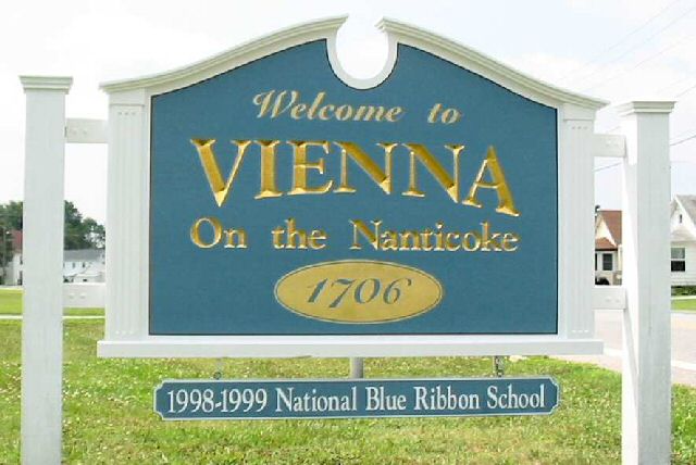
Our Vision
"Vienna is envisioned as a gateway to the
Nanticoke River and Watershed and a model Chesapeake Bay community which is
conservation-oriented and respects its heritage and natural environment while
planning progressively for the future."
Greater Vienna Comprehensive Plan 2003
Our Goals
"Facing potential significant growth and change
in the 21st century, Vienna has a tremendous opportunity to link and protect
cultural, historic and recreational opportunities, while accommodating
appropriate development."
Russell Brinsfield, Mayor.
Emperor's Landing and
Chesapeake Bay Gateway Network
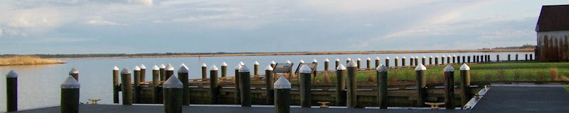
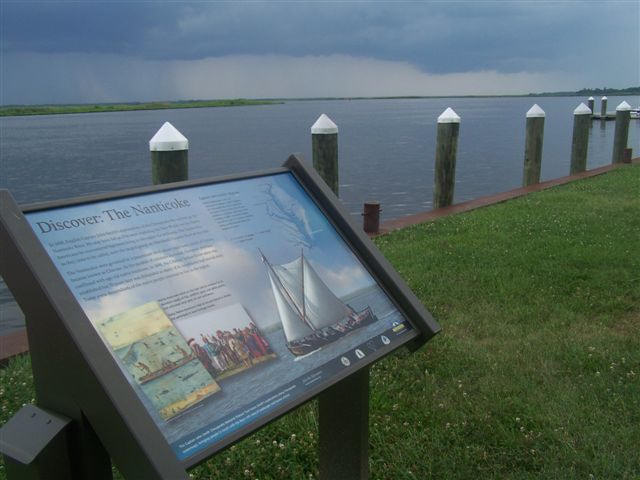
In 2009 Vienna became a Chesapeake Bay Gateway
Network site. The name of the Vienna Waterfront Park was changed to Emperor's
Landing and has now been upgraded in a multi-year improvement program funded by
the Maryland Department of Natural Resources. The town acquired the former
industrial properties along the water during the past few years. Dilapidated
structures were demolished and a new river walk, low profile stone revetment
and marsh creation project have been implemented. Construction of 10-12
transient floating docks and a bayscapes landscaping event have also been
completed.
Currently, extension of the river walk, floating
docks, bulk heading and other substantial landscaping, including prototype
signage for the John Smith Chesapeake National Historic Trail, have been
implemented in phases with construction largely completed in 2008 with funding
help from NOAA, the Department of Natural Resources, and the Dorchester County
Tourism Office.
The renovation of the town owned Coast Guard Station was completed in 2010.
It now serves as a multi-purpose, visitor friendly, ADA compliant convenience facility with flag court.
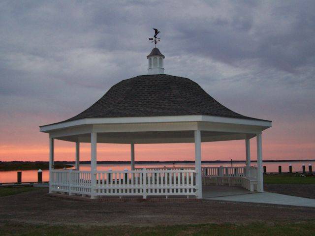
Construction of a nearby public picnic pavilion was completed in 2011. Other long term development goals
for the waterfront park include an expanded boardwalk with adjacent nature trails and
additional walk ways and landscaping throughout the park.
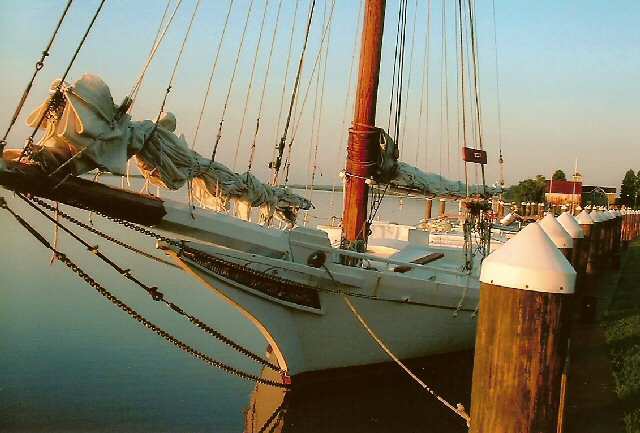
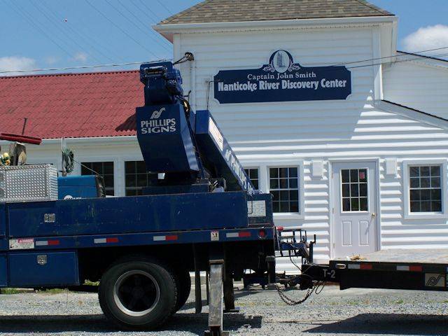
Captain John Smith Chesapeake National
Water Trail and Nanticoke River Discovery Center
The establishment of the Captain John Smith
Chesapeake National Historic Water Trail by Congress in May of 2007, and the
designation of Vienna as a Port of Call for the replica John Smith Shallop on
its historic 1608 reenactment voyage up the Nanticoke in June of 2007 helped
establish the feasibility and desirability of a discovery center being located at
Vienna.
The Captain John Smith Nanticoke River
Discovery Center will be a scientific exploration, economic development and
river heritage tourism center for Vienna, with a focus on Captain John Smith's
initial encounter with the native Nanticoke population. It will build on this river
community's rich history, cultural heritage and environmental legacy.
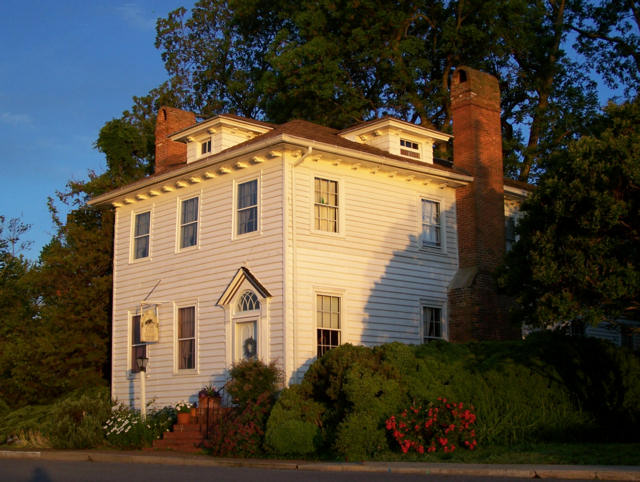
On August 6th 2008, Governor O'Malley announced
the acquisition of the Historic Nanticoke Inn and property in Vienna, which
will become a waterfront visitor's center on the Captain John Smith Chesapeake
National Historic Trail. Renovation of the historic inn began in 2011, with a spring,
2014 completion date anticipated. Museum displays, an adjacent river kayak launch and other amenities will follow.
Letter of Support: November 1, 2010, Office of the Governor.
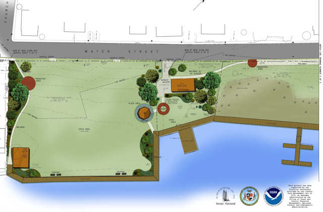
Town Center District
On April 4, 2005 Market Street was extended into
the Ocean Gateway Route 731 corridor to facilitate the redevelopment of the
Vienna "Town Center" Business District, which would emphasize small shops or
businesses combined with residences on Market Street as well as new commercial
development on sites adjacent to the new Market Street & Old Ocean Gateway
intersection..
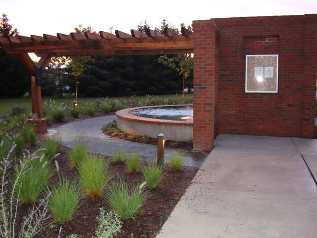
A landscaped town entrance park located near the
intersection of MD RT 731 & 331 opened in 2009. This park will enhance the
entrance to the town and the surrounding area with a family friendly
environment including a reflection pool with brick artifact, native flower and
shrub plantings, decorative stone pathways, and convenient benches.
Future Development
The Community Vision Plan suggests the creation
of a residential development zone south and west of town that would include
open space and a green belt buffer area that would be integrated into the
existing town character and fabric. This plan would help maintain the rural
legacy of Vienna by protecting the significant wetlands adjacent to the
Nanticoke River, including the Mill Creek Natural Heritage Area, and the
neighboring farms and forests currently surrounding the town with a green belt
buffer that would effectively delineate future growth areas.
On June 11, 2008, Governor Martin O'Malley
announced that the Maryland Board of Public Works had approved the purchase of
276 acres south of town for a green belt buffer area for $4.6 million funded
through the State’s Program Open Space.
Currently, this tract of land has been annexed into
the town and is being improved with best farming practices, enhanced buffers, and native
plantings under the review and guidance of the Maryland Department of Natural Resources.
|